

Pathanamthitta records technically perfect monsoon balance after heavy rain in July
Mail This Article


Pathanamthitta has pulled off a rare meteorological feat, recording a zero-percent deviation between its projected and actual seasonal rainfall. Between 1 June and 6 August 2026, the district, which was staring at a standard monsoon deficit, registered exactly 105.1 cm of rain against a 50-year historical average expectation of 104.8 cm.
While neighbouring districts continued to struggle with significant dry spells—Kottayam recorded a 9% deficit, Kollam 28%, and Alappuzha 23%—Pathanamthitta balanced its ledger overnight. Before the catastrophic deluge on 31 July 2026, the district was suffering from a 10 to 15% rainfall deficit, mirrors of its coastal and midland neighbours.
Historic deluge in the eastern hills
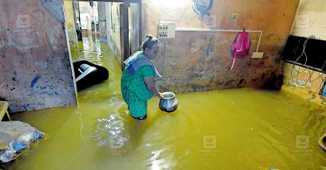
The dramatic recovery in statistics is primarily attributed to an extreme weather event in the district's eastern highland belt. Areas like Laha and Pathanamthitta town witnessed an astonishing 24 cm of rain dumped in a single night—a deluge that is highly likely to be an all-time record. Although some localised private weather stations registered rainfall exceeding 30 cm, the India Meteorological Department (IMD) relies on official metrics. Such hyper-local data, however, remains crucial for the state and district disaster management authorities to plan preemptive rescues and relief operations.
Monsoon projected to linger
While the immediate threat of devastating floods has subsided, meteorological projections indicate that the rains over Pathanamthitta's eastern highlands are far from over. The traditional "Karkidakam" downpour is expected to continue intermittently. Long-range forecasts suggest a brief respite by mid-August, followed by another wet spell towards the end of the month, before finally subsiding in time for the Onam festival season. This pattern aligns closely with traditional agricultural wisdom that dictates non-stop rain during this Malayalam month.
Why desiltation is not a cure-all
The severe inundation of major arterial networks—including the TK Road at multiple points, the MC Road at Thiruvalla Kuttoor, and parts of Ranni town—has triggered intense debate among environmentalists and hydrologists. Eminent environmentalist Prof Thomas P Thomas urged the Public Works Department to map these recurring flood zones and design climate-resilient roads rather than banking on outdated flood control methods. Prof Thomas emphasised that simply dredging sand and silt from local rivers is a superficial fix, noting that modern climate patterns bring three to four times the volume of rain in highly condensed timeframes.
The dangers of deep dredging
Supporting this view, dam management expert James Wilson pointed out that comprehensive desiltation of the Pamba river would, at best, increase its water-carrying capacity by a mere 10%—hardly enough to mitigate extreme flash floods. Furthermore, water resources expert Dr Subhash Chandra Bose warned that over-dredging the riverbed would lower the water table, triggering severe bank erosion and causing saline water intrusion from the coast during the dry summer months. Experts argue that the state must shift focus from ad-hoc river dredging to permanent, scientifically engineered flood-management systems that accommodate these intense, rapid-precipitation events.
