

Ranipuram trek guide: Through Kasaragod’s misty hills and forest trails

Mail This Article


As the northeast monsoon brings rain and mist to Kerala, Ranipuram in Kasaragod draws visitors to the Western Ghats. Often called the ‘Ooty of Kerala’, it offers a trek through mist-covered mountains, dense forests and rolling green hills.
The trail begins under a canopy so thick that sunlight reaches the forest floor only in patches. Roots twist across the path, doubling as steps as the climb gets steeper. The air is cool, the forest floor damp, and insects fill the silence.
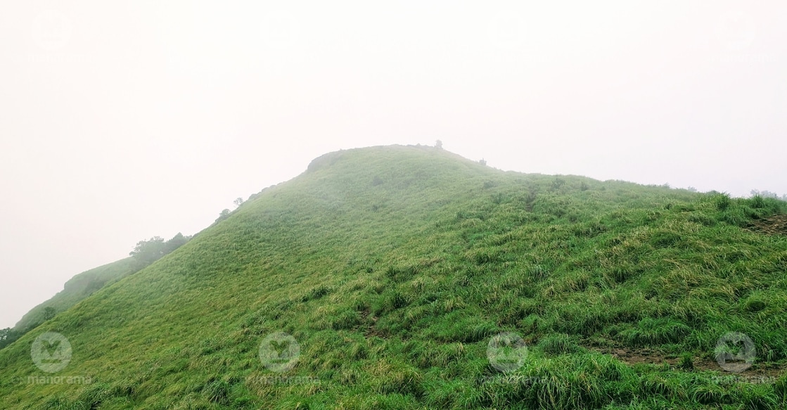
Then, almost suddenly, the canopy opens. Green hills roll towards the horizon. Clouds drift over the mountains, concealing them briefly before lifting to reveal the landscape again. On a clear day, the hills of Karnataka are visible in the distance.

Located in the Panathady grama panchayat of Kasaragod district’s Vellarikundu taluk, Ranipuram lies close to Kerala’s border with Karnataka’s Kodagu region. The nearest railway station is Kanhangad, roughly 49km from the trailhead. The trek begins at the Forest Department check post, about 9km from Panathady town.
All-season trail through mist and forest
S Madhusoodanan, president of the Vana Samrakshana Samithi (Forest Protection Committee), said Ranipuram had no off-season, though visitor numbers tended to rise during the monsoon. Some visitors came simply to enjoy getting drenched in the rain.
The first stretch passes through dense forest. After about 10 minutes of climbing, the trees begin to thin out, revealing the first viewpoint. To the left lies the Talacauvery region of Karnataka, while the Western Ghats stretch into the distance.
The region falls under the Panathady section of the Forest Department’s Kanhangad Range, said Rahul, who works with the department’s Kasaragod division. Fog is a defining feature of the trek. It sweeps across a slope within minutes, swallowing the distant mountain ranges before retreating just as quickly. The weather is equally unpredictable, shifting from sunshine to clouds and rain, then back to sunshine.
The trail soon winds back into the forest, where the temperature drops noticeably. Lichens cling to tree trunks, while plants and fungi grow among the rocks and on the damp ground. Visitors should admire the fungi from a distance and avoid touching or eating them, Madhusoodanan warned.
A forest watch house overlooks a steep valley. Further along, a second viewpoint, with benches and refreshments, offers a place to rest before a rockier stretch, a steep descent and the final climb to Ranipuram’s peak.
Monkeys are common along the route, while peacocks can be heard calling from the slopes. The surrounding forest is also home to elephants, deer, wild boar and bears, Madhusoodanan said. Wildlife sightings were never guaranteed, but a lucky few had spotted gaur too, he added. A watcher appointed by the samithi keeps an eye on the area.
How challenging is the trek?
The climb is moderately challenging. Though the route is relatively short, some stretches are steep, with exposed roots and rocks that can become slippery in the rain. Madhusoodanan said people of all ages undertake the trek, although older visitors might find the steeper sections demanding.
The designated trail is 2.5km each way, making the round trip about 5 km. This takes approximately two to three hours, including stops. The peak stands about 1,048 metres above sea level and offers sweeping views of the surrounding mountains.
“There is only one designated trail to reach the summit of Ranipuram,” Madhusoodanan said. Although other paths lead to the summit, they are better known to locals. Some visitors strayed from the designated route and got lost, requiring forest staff to bring them back, he added.
A hill with a history
Beyond its trekking trails, Ranipuram has a history of landholding families and migration that shaped the communities living here.
Anujith Sashidharan, an English teacher at St Mary’s College, Panathady, who is well-versed in the area’s history, said the hill was once known as Madathumala, a name that continues to appear in some tourism descriptions.
During the 16th and 17th centuries, the land was held by landowning families such as the Kodoth family. Around the same period, Marathi-speaking communities arrived and settled in areas around Madathumala. They were among the early settlers of the region, Anujith said, though their numbers remained relatively small.
Following Independence and the implementation of Kerala’s land reforms in 1964, the region began to change. During the 1970s, Christian families from Kottayam and other southern districts moved to the area, purchasing land from the Kodoth family and taking up farming. Over time, they came to outnumber the communities already living there, according to Anujith.
The name Ranipuram emerged during this period. “Ranipuram was the highest peak here. The Christian community named the hill out of devotion to Mary, mother of Jesus,” he said.
The name draws on Rani, meaning queen, a reference to Mary as the Queen of Heaven. It gradually gained currency through everyday use during the 1970s and 1980s before becoming official in the 1990s, according to Anujith. Ranipuram thus came to be known as the ‘queen of hills’, he said.
Plan your Ranipuram trek
Entry costs ₹60 for adults and ₹25 for children. The hill is open from 8 am to 5.30 pm, but entry to the trekking trail closes at 3 pm. Trekkers must return by 5.30 pm.
The samithi manages trekking activities in collaboration with the Forest Department. Kannur and Mangaluru are the nearest airports. Start early, carry enough water and wear shoes with a good grip. Mobile phone connectivity may be unreliable, and rain can sharply reduce visibility. Ranipuram’s appeal lies as much in the walk through the dark forest as in the views from the summit. The trail’s emergence into the open hills is part of what makes the climb memorable.
How to reach Ranipuram
By road
From Kanhangad, take the Kanhangad–Panathur highway and travel about 40 km to Panathady. At Panathady junction, turn right and continue for another 9 km along a scenic hill road to reach the Panathady Forest check post. Parking is available near the check post.
By bus
The KSRTC bus from Kanhangad leaves at 8.05 am and reaches the Forest check post at 9.30 am. It begins its return journey to Kanhangad at 10 am.
An afternoon service leaves Kanhangad at 2.50 pm and reaches the check post at around 4.35 pm. The return journey begins at 5 pm.
Other options
Bus services are available from Kanhangad to Panathady junction. From there, private jeeps can be hired to reach the Forest check post.
