Israel apologises to India for map depicting J&K as part of Pakistan
Mail This Article
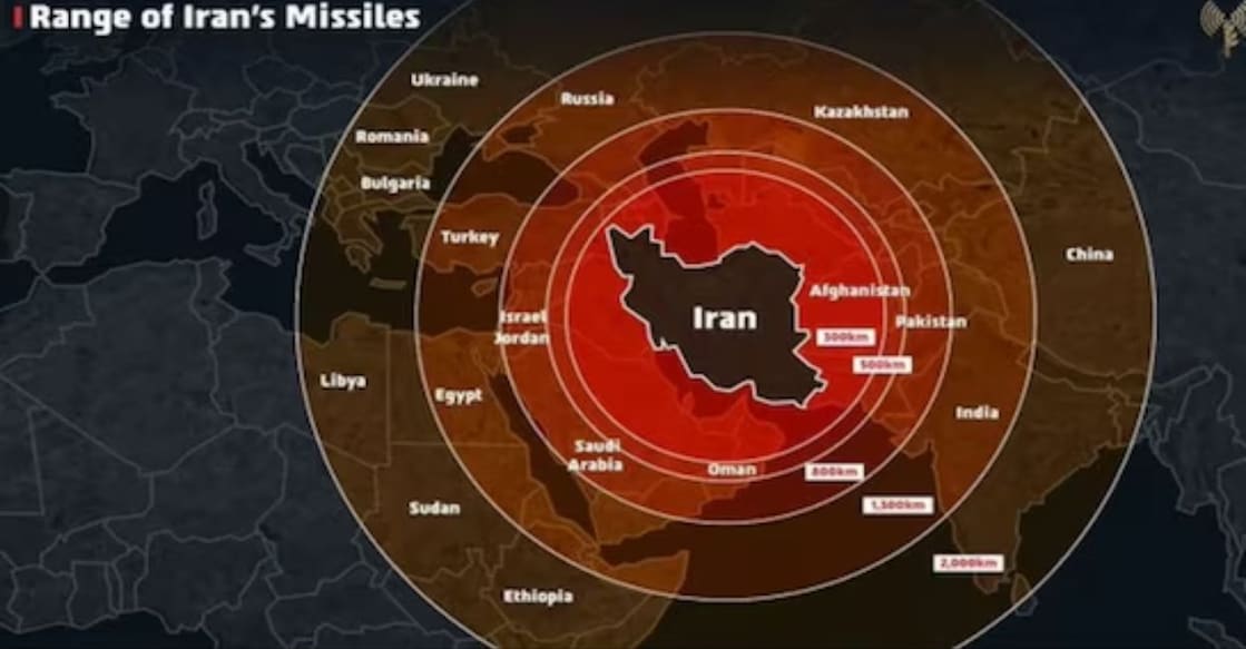
Jerusalem: The Israeli military on Saturday issued an apology for sharing a map that inaccurately represented Jammu and Kashmir as part of Pakistan, following backlash from Indian users on social media. The Israel Defence Forces (IDF) stated that: “This post is an illustration of the region. This map fails to precisely depict borders. We apologise for any offence caused by this image” in response to the uproar.
The map was posted on the IDF’s official X handle on Friday to illustrate the range of Iranian missiles. However, the depiction quickly drew criticism from Indian netizens. The Israeli Air Force also released a short video featuring a similar map indicating the range of Iranian missiles. Reacting to the controversy, Israeli Ambassador to India Reuven Azar took to X, calling the map a "bad, unintended" infographic and saying he had requested its immediate removal or correction.
“Now you understand why India remains neutral. In diplomacy, no one's really your friend,” a user commented on the post. India has consistently maintained that Jammu and Kashmir, including Ladakh, is an integral part of its sovereign territory.