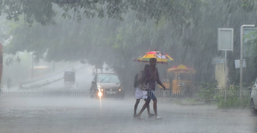
All you need to know about monsoon, forecast methods & flood chances | Listen to podcast

Mail This Article
The Indian Meteorological Department (IMD) has predicted southwest monsoon will hit Kerala on June 1. Private weather forecast agency Skymet, however, says monsoon has already begun in the state before its onset schedule.
Whatever be the case, Kerala is expected to get a normal southwest monsoon – about 250 cm of rain in four months from June to September – this year. This is worrying because the state experienced floods when it had received almost same amount of rain in 2018 and 2019.
In this context, renowned weather scientist Dr S Abhilash talks to Onmanorama about the monsoon, its history, types of monsoons Kerala receives, forecast methods, fixing onset date and the chances of another floods in the state this year. You can listen to the 30-minute podcast here.
Abhilash teaches at the Department of Atmospheric Sciences at the Cochin University of Science and Technology (CUSAT). He is the associate director of Advanced Centre for Atmospheric Radar Research at the same university.
This is the edited excerpts from Onmanorama's Let's Talk podcast.
What is monsoon and its history?
The word monsoon is derived from the Arabic word 'Mausim', meaning season. Monsoon is not just about rain. It is the transition in the wind directions. If the wind direction changes 180 degrees between two seasons, then the areas falling under them are known as monsoon regions.
Kerala get two monsoons – southwest and northeast – every year. The names have been derived from the wind directions. The monsoon that comes with the south-westerlies is known as south west monsoon. This season begins in June and ends in September.
After September, the wind direction changes 180 degrees and blows northeast from October to December. This season is known as northeast monsoon.
When we talk about the history of monsoon, we have to look at the 4.5 billion-year history of the Earth itself.
The main incident connected with monsoon was the 100 million-year-old collision of the Indian Plate with the Eurasian Plate that resulted in the formation of the Himalayas. This type of topography – the south east Asian landmass covering the Himalayas, Tibet and vast Indian Ocean - is essential for change in the wind direction.
Of the southwest and northeast monsoons, which one is the strongest?
Considering the duration, intensity, and amount of rainfall, southwest monsoon is the strongest of the two monsoons. Southwest monsoon covers the southern hemisphere from Madagascar to Japan. Northeast monsoon, on the other hand, is limited to southern peninsular region of India before moving to Australia.
What are the criteria for fixing the monsoon onset date?
The monsoon onset date will be decided based on certain objective criteria. They are:
1. If 60% of 14 rain gauge stations in Kerala record 2.5mm of rain for two consecutive days, then the the second day will be considered as the onset.
2. There should be westerlies and the depth of the wind should extend from lower level to middle level.
3. Presence of organised clouds.
However, different agencies use different parameters. IMD mainly consider cloud formation over Western Pacific Region, large-scale sea surface temperature over Central Pacific and then zonal winds in the Southern Hemisphere. The agency has predicted monsoon will hit Kerala on June 1.
What are the methods adopted for seasonal forecast?

West Coast and North Eastern regions in India receive maximum rain - around 250 cm to 300 cm – every year. Central India receives around 150 cm of rain. This is the spatial inhomogeneity in the rainfall. So the average rainfall in India is around 90 cm.
Earlier, the IMD used statistical models for seasonal forecasts. But from 2012, it started using the most sophisticated dynamical model that can predict intra-seasonal and spatial variabilities. The statistical model is only good at predicting normal monsoon. Excess and deficit monsoon cannot be predicted with this model.
How much rain will Kerala get this time? Will it face another floods?
IMD issued a normal southwest monsoon forecast for Kerala. This means that the state will get rain between 210 cm and 230 cm. We should remember that there is no direct link between a normal monsoon and floods.
Kerala faced floods in 2018 and 2019. In 2018, the state got around 250 cm of rain in just three months – June, July and August. In 2019, it got 230 cm of rain. June and July were rain deficit, but it got excess rain in August and September.
Kerala will not face floods if we get equally distributed rain in these four months.

